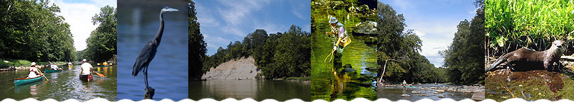
This section of the South Fork of Wildcat Creek
is approximately 10 miles in length and generally
requires 4-5 hours to float. Logs in or across
the creek, particularly between State Road 38
and Monitor Access Site, may be encountered seasonally,
and a portage may be required.
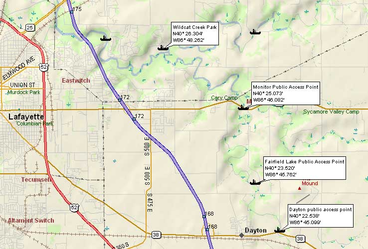
The put-in is downstream of the State Road 38
bridge (on the eastern edge of Dayton), along
Co. Rd. 800E, on the right bank of the creek.
Stay close to the bridge and follow the path to
the creek. Parking is available for a couple of
vehicles along the County Road.
For the shuttle route, travel north on Co. Rd.
800E, bear left, then turn right as the road becomes
Co. Rd. 775E. Cross over the Middle Fork of Wildcat
Creek and State Road 26 (to go to Monitor Access
Site, turn left (west) on State Road 26 and continue
for about two-thirds of a mile), then continue
until the road curves left, passing the Mis-so-la
access site and becoming Co. Rd. 725E after crossing
the North Fork of Wildcat Creek. After the road
straightens, turn left (west) at Co. Rd. 300N
and proceed to Co. Rd. 600E. Then turn left (south)
on Co. Rd. 600E and proceed to where the road
turns right (west) and becomes Eisenhower Road.
First Wildcat County Park is located on the left
(south) side of Eisenhower Road.
It has been recommended that this section of
the river (from Pathway Park to Monitor) should
be canoed only during highflow. However, remember
that only experienced canoers should canoe during
highflow.
The Department of Natural Resources' Monitor
Access Site, upstream of State Road 26 bridge
on the right bank, has a parking lot for a few
vehicles and provides easy access to the creek.
In low water (and for most of the summer) the
Monitor Access Site to First Wildcat County Park
segment of the creek, or on downstream on the
North Fork to the Wabash River and Davis Ferry
County Park, provides a better trip than one beginning
at State Road 38. The section of Wildcat Creek
from Monitor Access Site to First Wildcat County
Park is approximately 4 miles in length and requires
about 2 hours to float. Floating from Monitor
Access Site to Davis Ferry County Park requires
6-8 hours; it is a 13 mile trip.
Emergency service is located in Lafayette.