|
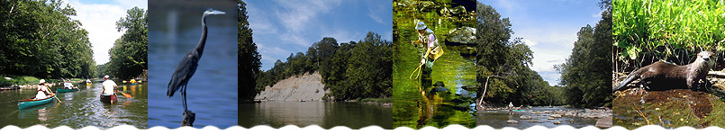
Distance: At 4.5 miles this section
takes about 1.5-3 hours to float
River Features: This is also one of
the better canoeing sections in the valley, offering reliable
water level and short riffle stretches. The depth of the
creek in this section becomes 2-3 feet, and the average
width is about 60 feet. There is little development along
this stretch, though you will see dense hardwood forests,
and steep ridges and banks. Game fish in this stretch
reflect relatively good water quality; they include smallmouth
bass, rock bass, white bass, catfish, sauger and various
panfish species.
About halfway through the trip you'll encounter the triple-drop
rapids (see below). The take-out at Wildcat Park is easily
identifiable by a large sandy beach on the right bank
(just where the South Fork joins the creek from the left).
Hazards: About halfway through the trip
you'll encounter the triple-drop rapids, probably the
most exciting riffle on the creek. It's not whitewater,
but it's exciting, and the water can really get moving.
|