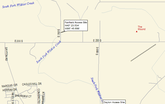
Fairfield Access
Site
Location: From Dayton, turn left and
head north on CR 800 E. Turn left (west) onto CR 200 S,
then just before the bridge over the creek, turn right
(north) onto CR 750 E. Fairfield Public Access Site is
located just NW of the intersection of CR 200 S and CR
750 E. (GPS: approx. 40.2350, -86.4572)
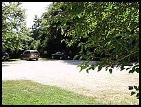
Parking: There is a gravel parking lot
with room for about 10-12 vehicles, including 2 paved
wheelchair accessible parking spots.
Path to River: The path is paved and
wheelchair accessible most of the way. However, it does
become a dirt path that may be overgrown at times. There
is a total hand carry of approximately 40 yards (120 feet).
River Access: There is room to load/unload
many boats at a time (depending on water level), and there
is room to linger on the gravel bar.
The Fairfield Public Access Site is maintained by the
Indiana Department of Natural Resources.
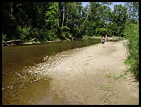
river access |
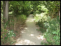
paved path (most of the way) |
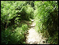
dirt path to the river |
|
parking area |
|
|