|
Distance: At 13.6 miles this section
generally takes 5-7 hours to float.
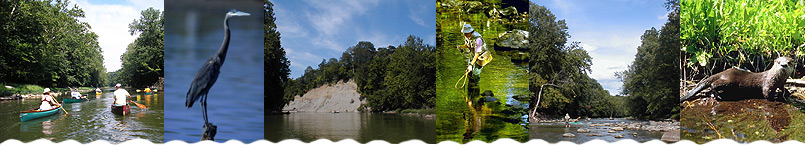
River Features: This section offers
scenic canoeing in a natural segment of the creek. About
1 mile downstream of the put-in you will pass under the
Adams Mill Covered Bridge. About 1 mile later you will
pass under a railroad bridge, and 1/2 mile after that
the creek flows under the SR 75 bridge.
Downstream of the State Road 75 bridge (just past Cutler)
deer, beaver, muskrats and various hawks and owls may
be seen. About 4.5 miles later you will pass under the
Prince William Road Bridge. Then 2.7 miles later, after
a series of riffles, the creek flows under the Lancaster
Covered Bridge (Co. Rd. 500 W bridge), which is well preserved
and popular with photographers. About 1 mile later you
will pass under a railroad bridge, and about 1/2 mile
after that the creek passes under the SR 421 bridge. In
2.3 more miles you will come to the Knop Lake take-out
on the left bank. The sign for the take-out is not easy
to see, but there is a notable medium-size, round rock
in the middle of the creek.
Hazards:
|