Wildcat Creek Natural Scenic River in Indiana

WILDCAT CREEK RIVER SEGMENTS
North Fork: Wildcat Park to Peters Mill

North Fork Lower Valley: Burlington to Adams Mill | Adams Mill to Knop Lake | Knop Lake to Mis-So-La | Mis-So-La to Wildcat Park | Wildcat Park to Peters Mill | Peters Mill to Davis Ferry

Distance: At 3 miles this section takes about 1-2 hours to float.

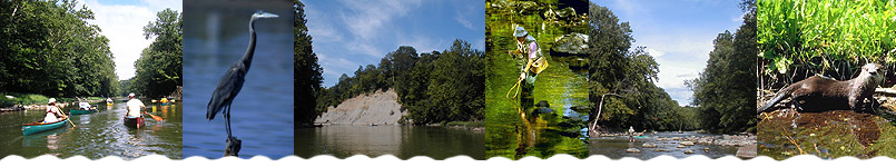
River Features: Wildcat Creek downstream of the confluence of the North and South Forks changes in character, and the creek's flow and width are nearly doubled. Canoeists can expect to encounter sand and gravel bars either exposed or forming riffle series. Shortly after passing under the Eisenhower Road bridge you will find the Peters Mill take-out on the left bank. It is clearly marked by a wood dock and steps up to the parking lot.

Hazards: From here to the Wabash River you need to be careful around any fallen trees and logjams. They may not look like much, but there is more flow here since the North and South Forks have joined, and the current can easily sweep you into a logjam.


Important: The river is constantly changing. Hazards like log jams and tree falls will come and go, so always be ready for them. Riffles will appear and disappear based on water flow levels. Do not attempt boating on this or any river during high water. Please be safe, respectful and responsible on the river.
www.WildcatCreek.net is made possible with the help of the Wildcat Guardians
copyright © 2004-2024 The Technological Edge, Inc. All rights reserved.
Site design by The Technological Edge, Inc.